Days 12-16 - Moab, Utah (1) - Canyonlands National Park and Dead Horse Point State Park
Moab, Utah is a bustling town in southeast Utah about a 3-hour drive (by RV) from Durango. It is located nearby to two spectacular national parks - Arches and Canyonlands. Each of these parks offers its own grand vistas and impressive geological formations that represent different examples of this amazing region. This is the first of two posts, one for each park.
We arrived from Durango on Saturday and found Arches (the closer of the two parks) to be very crowded with weekend visitors so on Sunday decided to drive to Canyonlands, about 30 miles away in hopes of smaller crowds (not so much, as it turned out).
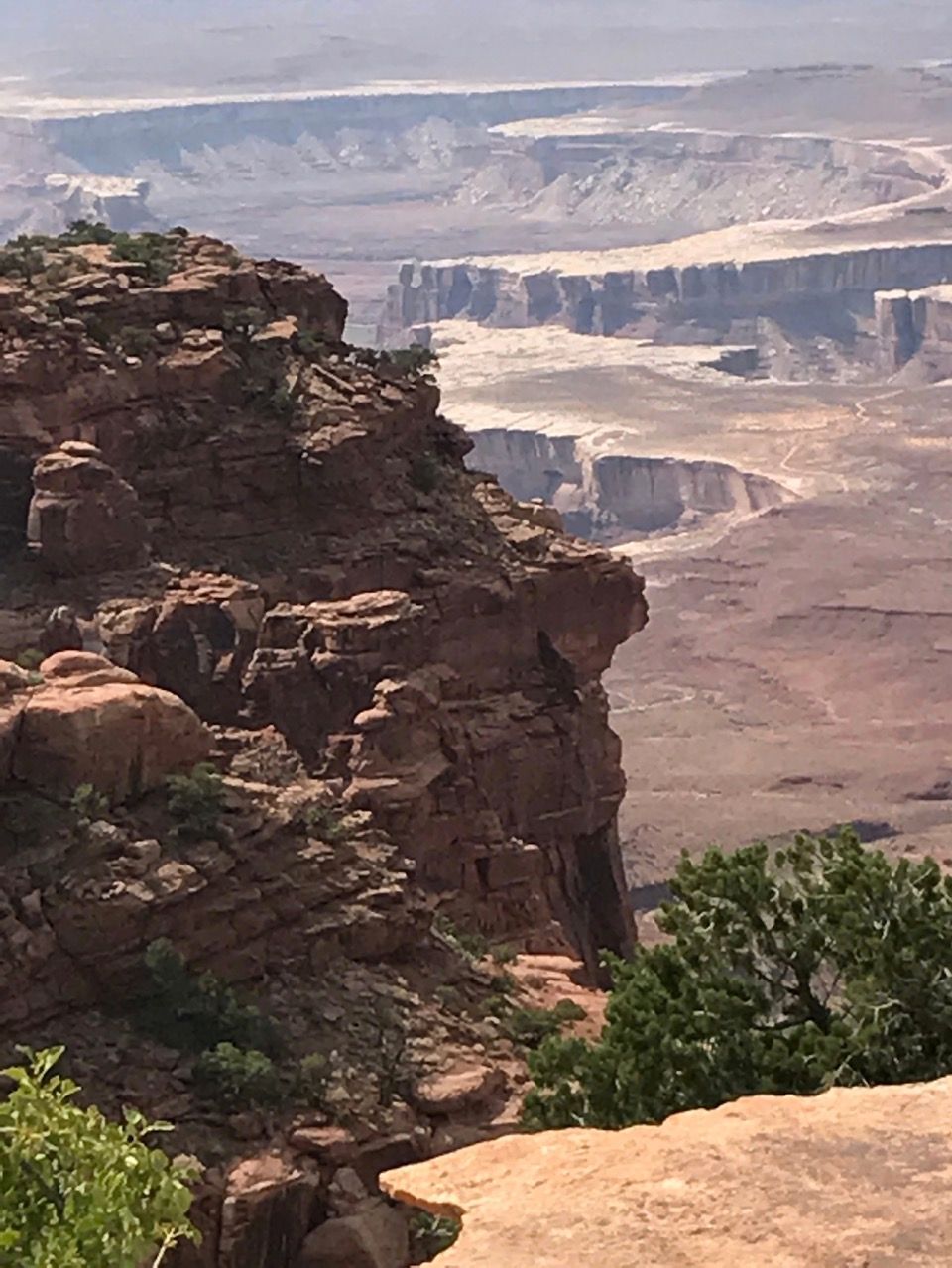
Canyonlands has been described as "a raw wilderness of mesas, buttes, sandstone fins, spires, and canyons" encompassing 527 square miles around the Colorado and Green Rivers. It actually has four distinct districts that could almost be considered separate parks as there are no roads connecting the districts within the park. Two of the districts, the Maze and Horseshoe Canyon are extremely remote, accessible only via 4WD vehicles. Of the remaining two, Needles and Island in the Sky, we chose to focus on the latter as it is the most accessible (and therefore the most popular). We also included a stop at the nearby Dead Horse Point State Park, located near Island in the Sky.
Island in the Sky is a huge mesa (40 sq. mi.) that sits at about 6000 feet above sea level, or about 2000 feet above the surrounding area. Even here, beyond the main road and a few branches, much of the area is very remote. As an example, the White Rim Trail is a 100 mile trail that takes about 3 days (!) in an 4WD vehicle (averaging 3 mph) requiring special permits. Definitely not even thinkable in a 28-ft RV! There are also accessible trails of various lengths and difficulty.
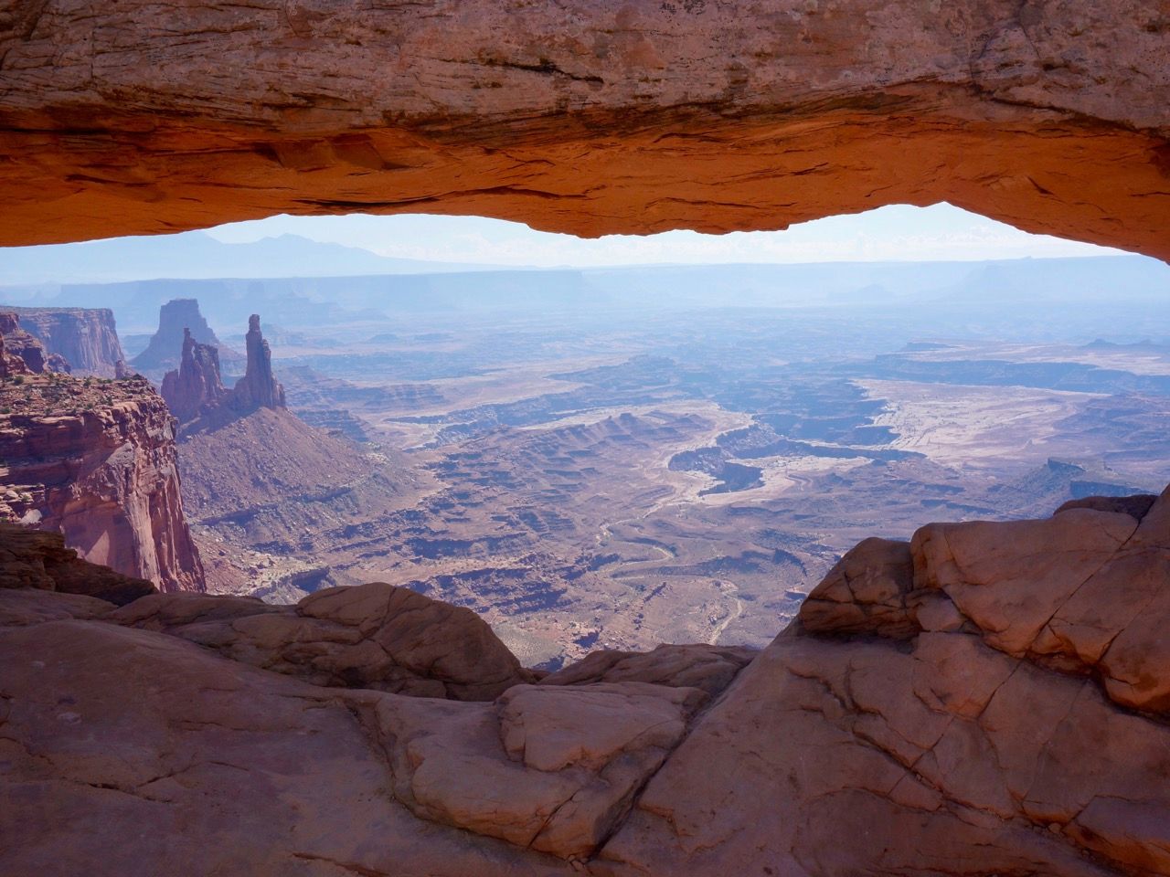
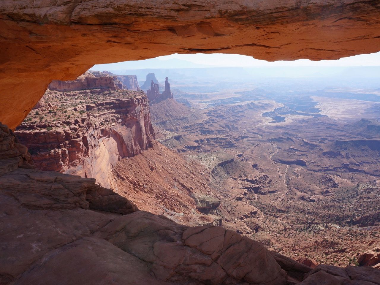
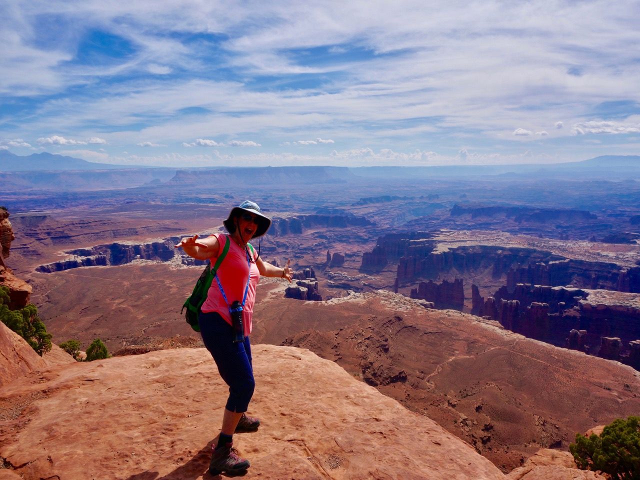
We did manage to visit a Mesa Arch, a spectacular view that was just a short walk.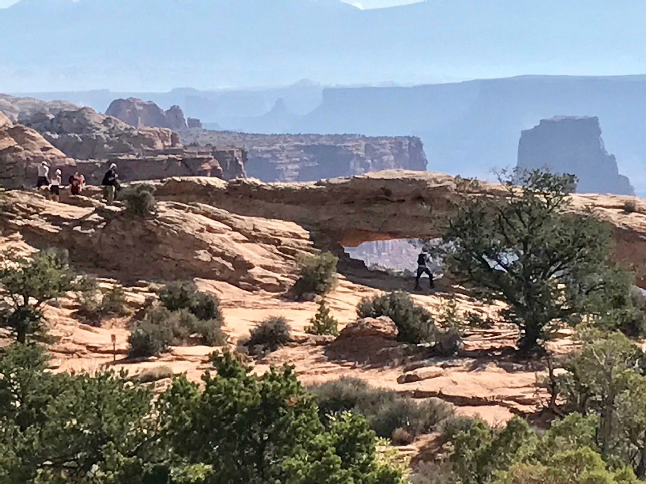
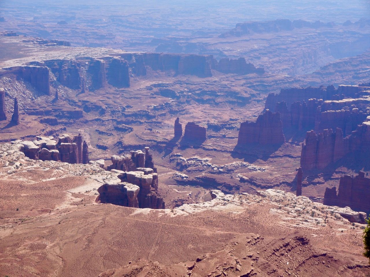
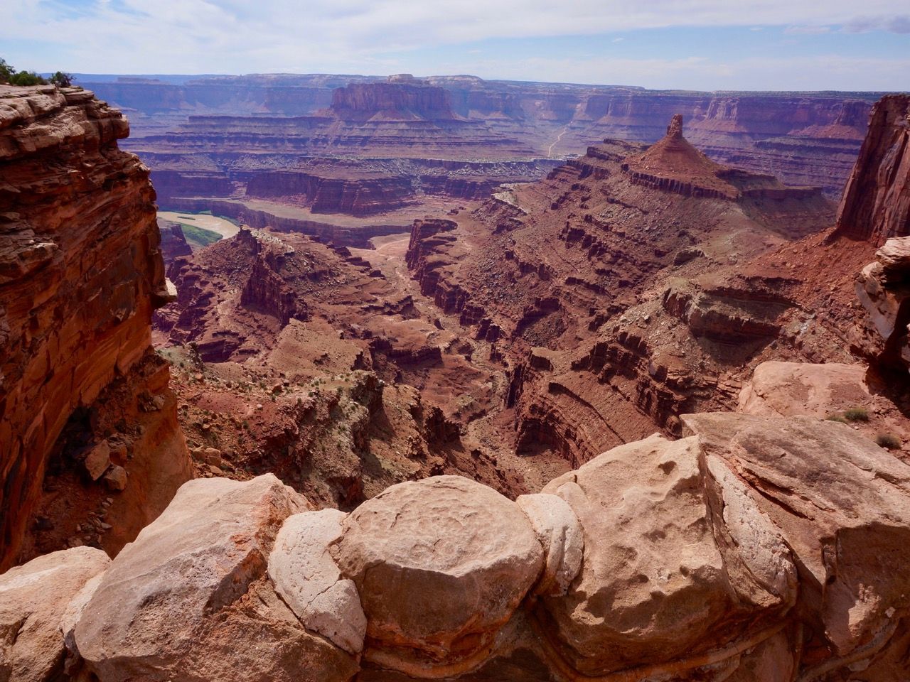
We also did the Grand View Trail, the southern-most point of Island in the Sky with a one mile trail trail and more incredible landscapes. We’ve said it before, but it’s impossible to capture what you see in person at these locations.
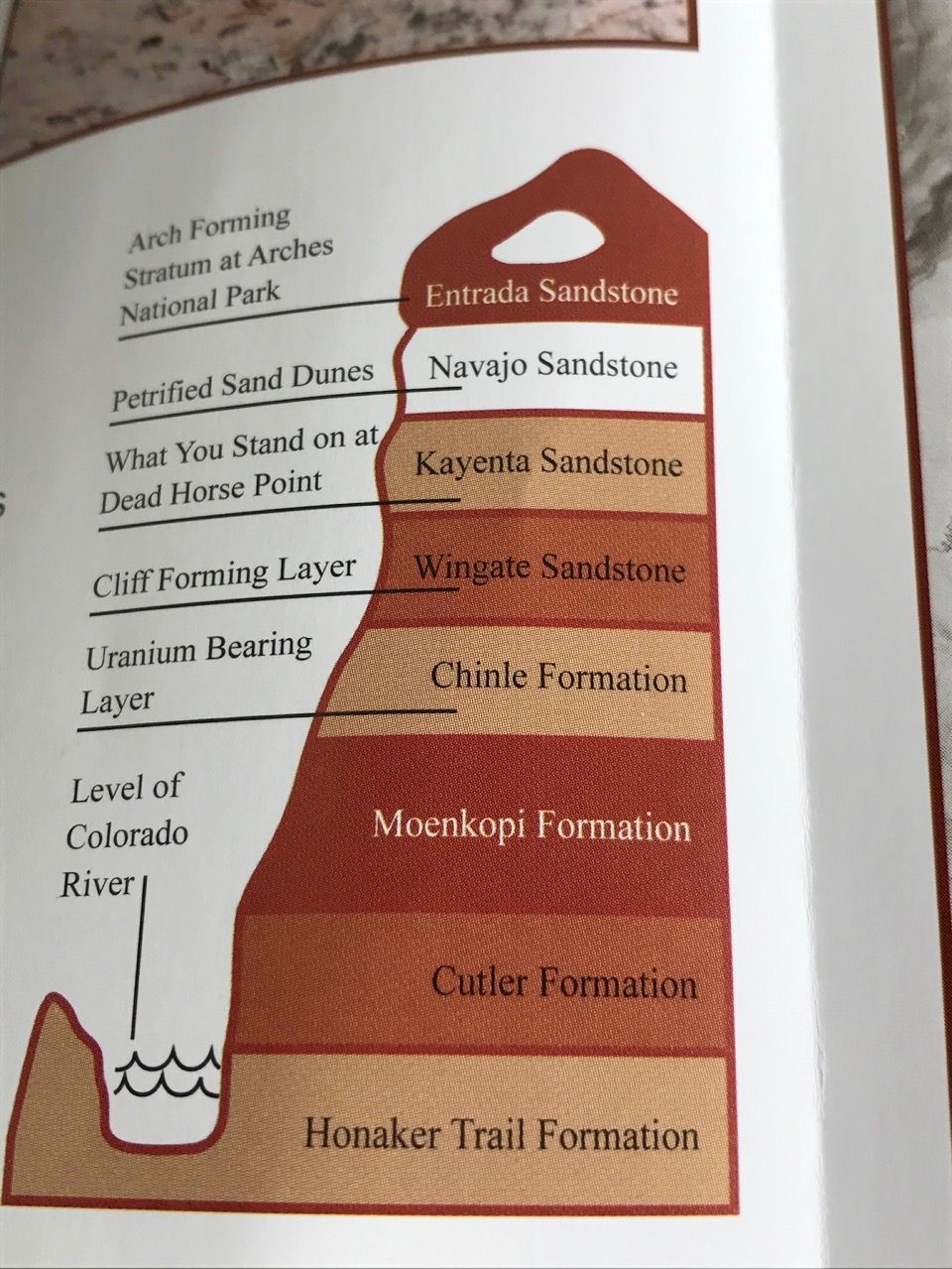
 At Grand View, we also listened to an excellent talk by ranger on the geology of the area, and the various changes that occurred over millions of years to form this unique landscape.
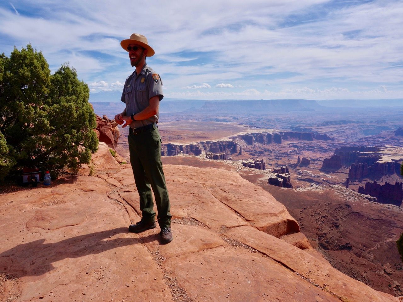
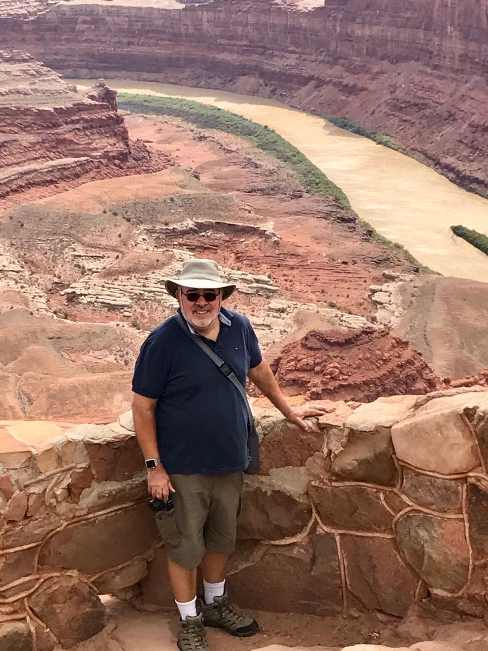
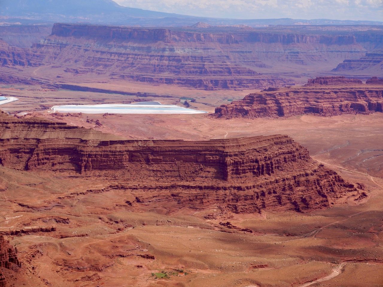
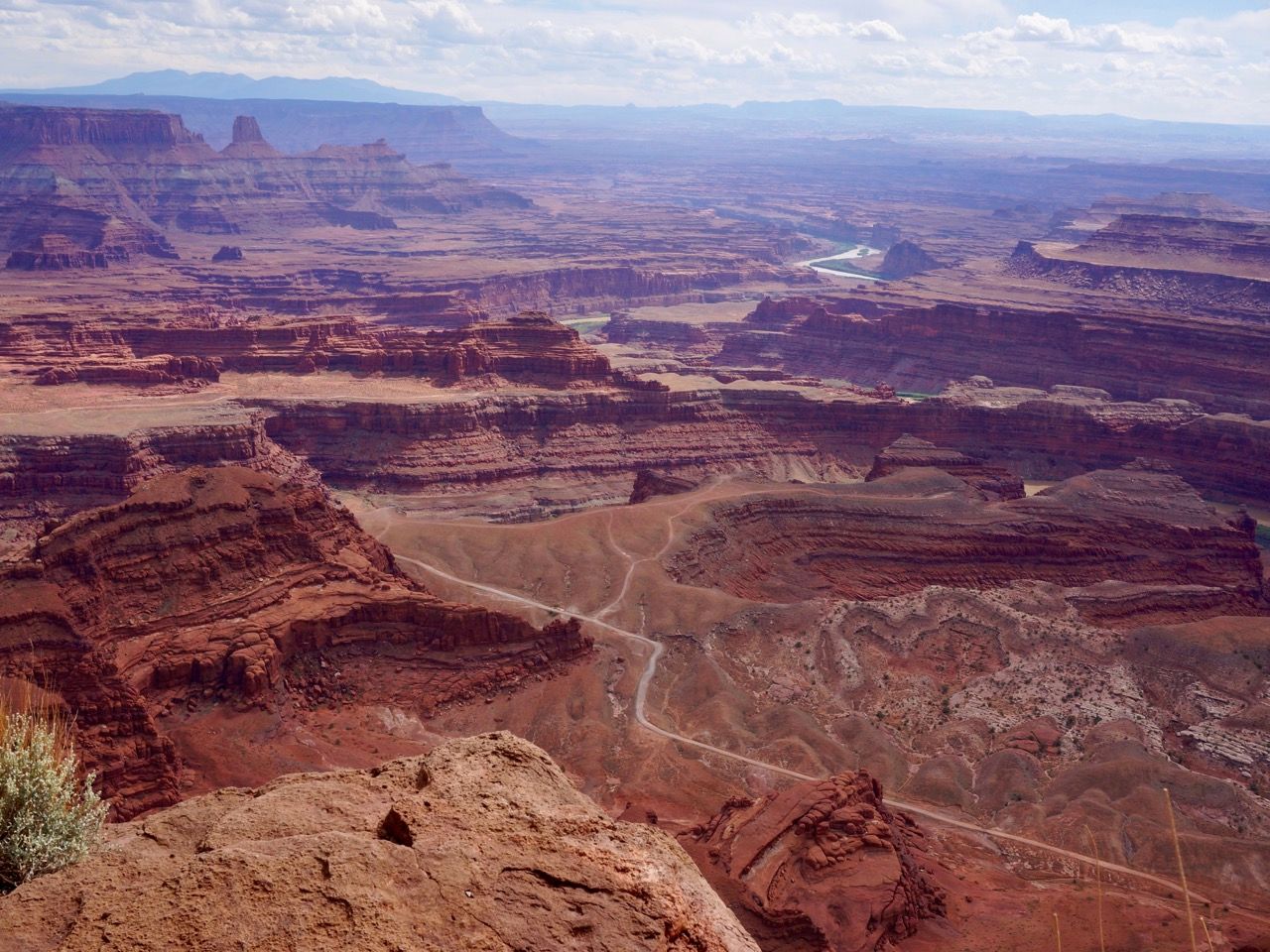
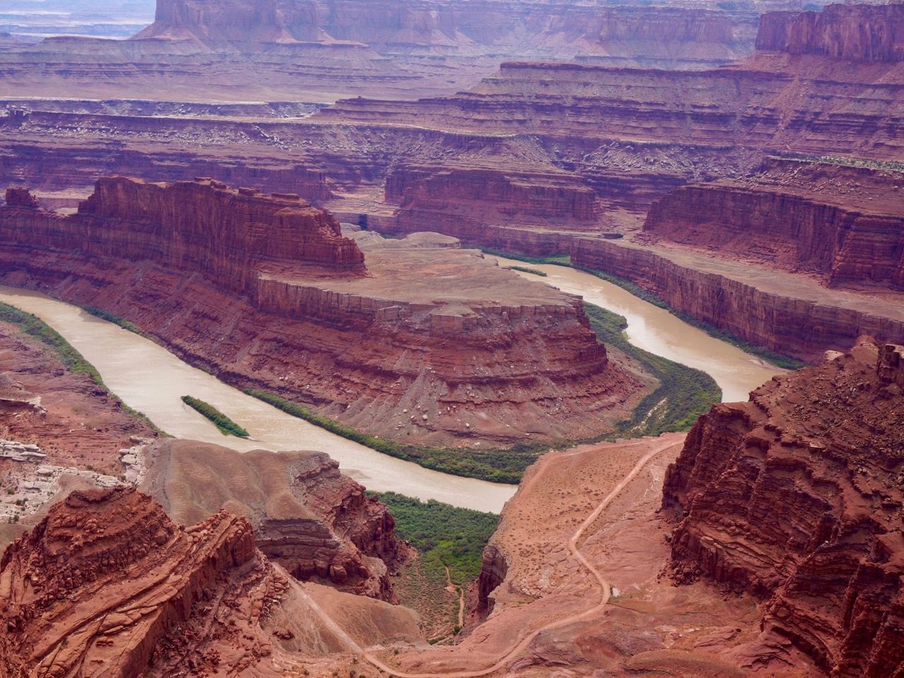
Near the entrance to Island in the Sky is a Utah state park called Dead Horse Point.
This can almost be thought of an extension to Island in the Sky. Here you see the Colorado River far below twisting its way through the canyons. You do see some signs of modernity, as well, as a solar collection field for gathering potash (potassium chloride) in the mineral rich area by the river is visible.
The name Dead Horse Point refers to a narrow neck of land off of the rest of the plateau where cowboys once herded wild horses. They would select the the most desirable, and, depending on which version of the story you choose to believe, either let the remaining horses go where many got confused by the unfamiliar geography and died, or were left corralled to die of hunger and thirst.
Canyonlands represents a great example of the variety of geology in the area. These parks all have great views and different rock formations, but they all have elements that make them unique. We’ll be doing a sidebar on the geology of the parks in a future post.

comments powered by Disqus